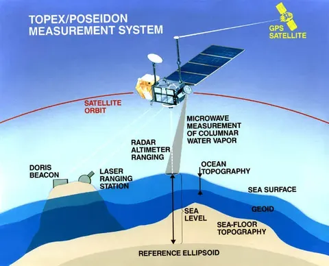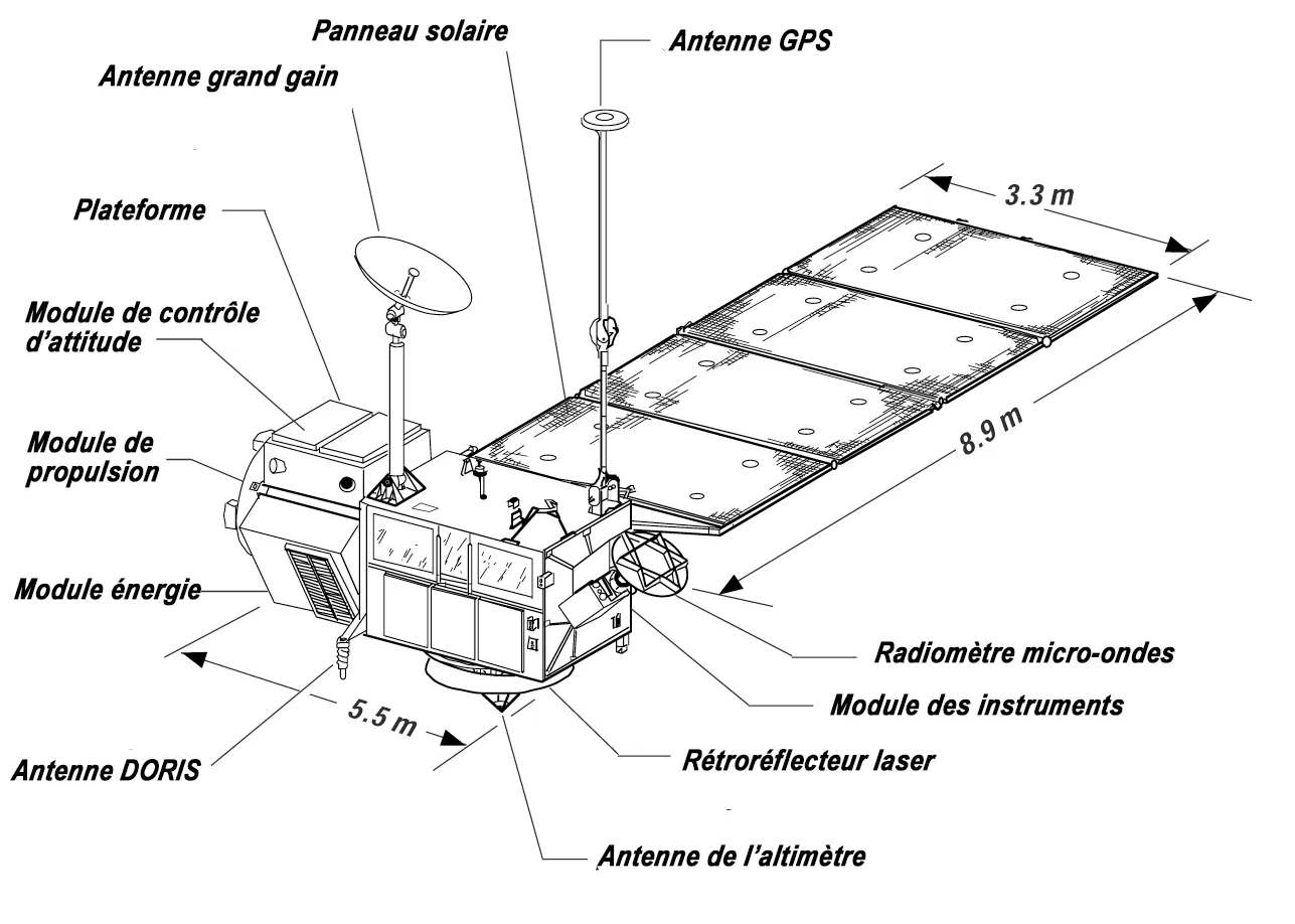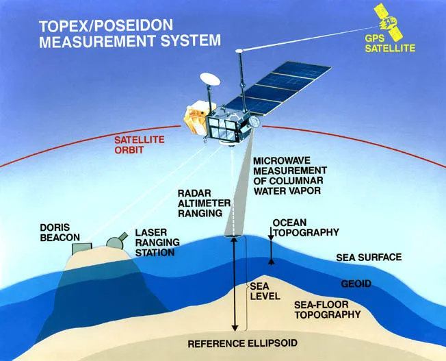

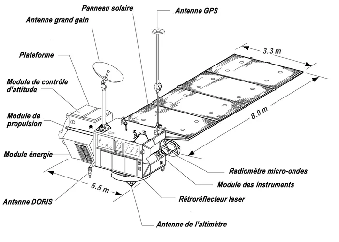
TOPEX/Poseidon measured the height of the sea. A radar altimeter bounced pulses off the ocean surface and timed the return to within a fraction of a nanosecond, while the spacecraft's own position was tracked to a few centimetres — allowing the sea surface to be mapped globally, repeatedly, to an accuracy of about three centimetres.
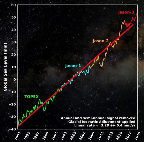
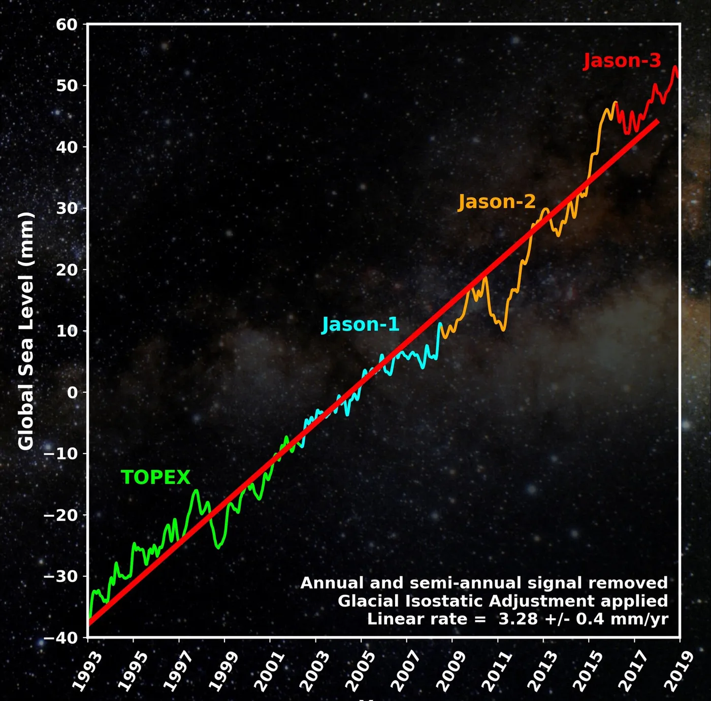
That precision was the achievement. Sea level rises by roughly three millimetres a year, which is imperceptible against tides, waves and weather, and measuring it requires an instrument stable enough to distinguish a trend from noise across decades. This mission began the continuous record that now underpins climate assessments.
It also revolutionised oceanography more immediately. Sea surface height reveals currents, because water piles up where currents circulate, and for the first time the global circulation could be mapped continuously rather than inferred from scattered ship measurements.
Its most publicised achievement was watching the 1997-98 El Niño develop, with a vast pool of warm water sloshing eastward across the Pacific visible in the altimetry weeks before its effects reached land. Seasonal forecasting of El Niño dates from this period.
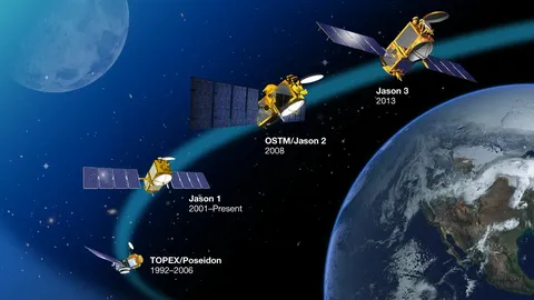
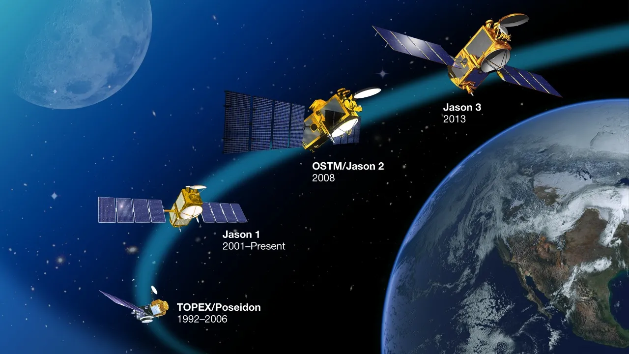
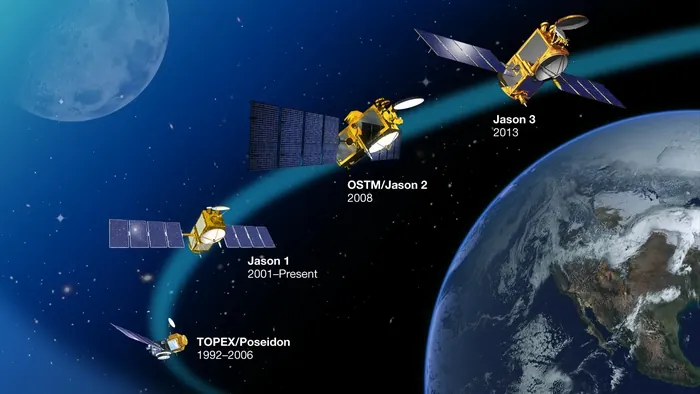
A joint American and French mission, it operated for thirteen years against a three-year design life, and handed over to the Jason series that has continued the identical measurement to the present — an unbroken thirty-year record maintained by deliberately overlapping successive satellites to cross-calibrate them.