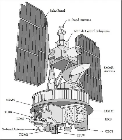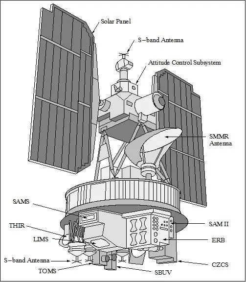

Nimbus-7 was the most consequential satellite of the series and one of the most consequential Earth observation missions ever flown. Two of its instruments in particular produced records that changed environmental policy.
The Total Ozone Mapping Spectrometer measured atmospheric ozone globally and daily. When British scientists reported severe springtime ozone losses over Antarctica in 1985, the satellite record was re-examined — and the depletion was found in the data going back years, having been flagged as implausibly low by automated quality control and set aside.

That episode is now a standard cautionary tale about validation procedures discarding real signals. Once reprocessed, the satellite data showed the hole's full extent and evolution, and it became the primary evidence base for the Montreal Protocol negotiated two years later.
The Coastal Zone Color Scanner was the first instrument to measure ocean colour from space, detecting chlorophyll and therefore phytoplankton. Intended as a one-year proof of concept, it operated for eight and produced the first global maps of ocean biological productivity, establishing the technique that SeaWiFS and its successors continued.
The satellite operated until 1994, sixteen years, and its data is still being reprocessed. Between ozone and ocean colour it produced two of the longest and most policy-relevant environmental records in existence.